Taking an overnight ferry from Piraeus Port of Athens to Heraklion


Crete is the largest and most populous of the Greek islands, it rests approximately 160 km south of the Greek mainland. It has an area of 8,336 km2 and a coastline of 1,046 km. As of 2020, the region had a population of 636,500.
Humans have inhabited the island since at least 130,000 years ago, during the Paleolithic age. Crete was the centre of Europe's first advanced civilization, the Minoans, from 2700 to 1420 BC. The Minoan civilization was overrun by the Mycenaean civilization from mainland Greece. Crete was later ruled by Rome, then successively by the Byzantine Empire, Andalusian Arabs, the Venetian Republic, and the Ottoman Empire. In 1898 Crete, whose people had for some time wanted to join the Greek state, achieved independence from the Ottomans, formally becoming the Cretan State. Crete became part of Greece in December 1913.
The island is mostly mountainous, and its character is defined by a high mountain range crossing from west to east. It includes Crete's highest point, Mount Ida, and the range of the White Mountains (Lefka Ori) with 30 summits above 2000 metres in altitude and the Samaria Gorge, a World Biosphere Reserve. Crete forms a significant part of the economy and cultural heritage of Greece, while retaining its own local cultural traits (such as its own poetry and music).


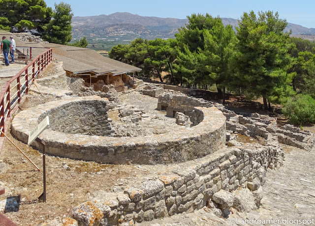
Phaistos is a Bronze Age archaeological site at modern Faistos, a municipality in south central Crete. Ancient Phaistos was located about 5.6 km east of the Mediterranean Sea and 62 km south of Heraklion, the second largest city of Minoan Crete.


A walk to Agiofarago gorge


The Tripiti Canyon is formed in the Asterousia Mountains. The canyon is 4 kilometres long and leads to a beautiful pebbled beach called Tripiti Beach.
The top of the canyon is at an altitude of 655 metres, near the church of Agia Paraskevi.
As you descend the canyon towards the sea, the road meets the riverbed and soon comes to the most impressive part of the canyon, the Steno Faraggi, which is only wide enough to fit one car through.


Driving to Chania


Chania is a city on the northwest coast of the Greek island of Crete. It’s known for its 14th-century Venetian harbor, narrow streets and waterfront restaurants. At the harbor entrance is a 16th-century lighthouse with Venetian, Egyptian and Ottoman influences. Opposite, the Nautical Museum has model ships, naval objects and photographs. The former monastery of St. Francis houses the Archaeological Museum of Chania


Driving to Palaiochora


From Palaiochora, overnight trip to the island of Gavdos
=> It is the southernmost point of Europe!
The island is 26 nautical miles south of Chora Sfakion. The area of the municipality, which includes the small island Gavdopoula, is 32.424 square kilometres. The island is roughly triangular in shape. Its highest point is Mount Vardia, 345 metres. The southeastern corner is a rocky peninsula with a natural arch carved by the elements, called Trypiti. A concrete sculpture of an oversized chair, built by a group of Russians who came to the island in the 1990s, sits on top of Trypiti.


Red Beach


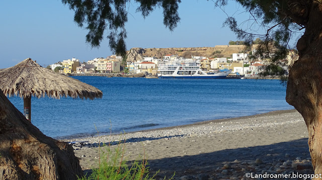
Rethymno was originally built during the Minoan civilization (ancient Rhithymna and Arsinoe). The city was prominent enough to mint its own coins and maintain urban growth. One of these coins is today depicted as the crest of the town: two dolphins in a circle.


Go to Heraklion and Western part of Crete :