
19 - 27 September 2023
During my trip in Argentina, as I arrive in Mendoza I notice that I am not far from Santiago do Chile and that from there maybe I could fly to one of my bucket destination : Easter Island!
I check the prices of flights and, at this period of the year (low season) they are reasonble.
My plan is quickly decided:
A) From Mendoza I will take a bus, cross the border into Chile to Santiago.
B) From Santiago, I shall take a flight to Easter Island.
... And do the reverse to get back to Mendoza.
I leave my Land Roamer in a safe campsite not far from Mendoza and with my backpack, take a big, comfortable bus to Santiago!


Having crossed the border near the Pass of Libertadores (3 200 m), on the Chilean side the road will take a VERY impressive serie of numerous switchbacks!
The road is wide, it's not an issue for big trucks with trailers.


This is my hostel in Santiago, before I fly to Easter Island the next day.


Located around 3 500 kilometers off the coast of Chile, Easter Island / Rapa Nui is a small, triangular volcanic island in the South Pacific famous for the gigantic stone statues called moai. Moai statues were considered by the early people of Rapa Nui as their ancestors or Tupuna that were believed to be the reincarnation of important kings or leaders of their clans. The Moais were erected to protect and bring prosperity to their clan and village.
Despite being one of the most isolated islands in the world (1), Rapa Nui clearly had an ancient indigenous population that left some remarkable remnants of its civilization.
At the moment, the island is home to around 8,000 permanent residents and most of its territory is covered by Rapa Nui National Park, a site that has been designated as a UNESCO World Heritage Site in 1995.
(1) The nearest inhabited land (around 50 residents in 2024) is Pitcairn Island, 2 075 kilometres away; the nearest town with a population over 500 is Rikitea, on the island of Mangareva, 2 606 km away; the nearest continental point lies in central Chile, 3 512 km away.


Marcelo is my host at the hostel in Hanga Roa, the main town of the island.

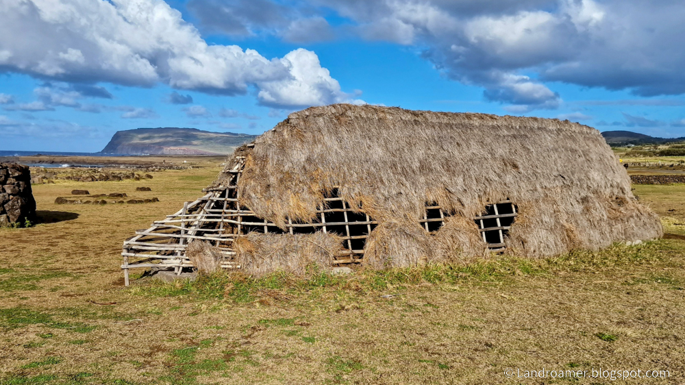
Here are a few picture of Hanga Roa and people that I met there


One evening, I went to watch a traditional dance and music show


Within walking distance of Hang Roa is a first serie of mois. The Tahai Ceremonial Complex was restored in 1974 by American archaeologist William Mulloy.
Tahai comprises three principal ahu from north to south: Ko Te Riku (with restored eyes), Tahai, and Vai Ure.


During the next few days, with a rented car and with organized tours
I will visit the most noteworthy archeological sites of the island.
NB - Many sites can ONLY be visited with an organized tour!

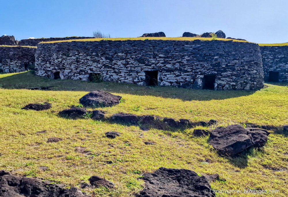
A) Cape Orongo
Orongo is a stone village and ceremonial center at the southwestern tip of Rapa Nui. It consists of a collection of low, sod-covered, windowless, round-walled buildings with even lower doors positioned on the high south-westerly tip of the large volcanic caldera called Rano Kau. Below Orongo on one side a 300-meter barren cliff face drops down to the ocean.
The Tangata manu "bird-man," was the winner of a traditional ritual competition on Rapa Nui to collect the first sooty tern (manu tara) egg of the season from the nearby islet of Motu Nui, swim back to Rapa Nui, and climb the sea cliffs of Rano Kau to the clifftop village of Orongo.


Not far, on top a hill, we are above the volcano of
B) Rano Kau
Rano Kau is a 324 m tall extinct volcano that forms the southwestern headland of Rapa Nui. It was formed of basaltic lava flows in the Pleistocene with its youngest rocks dated at between 150,000 and 210,000 years ago.
The crater is one of the island's only three natural bodies of fresh water.


=> From the Southern tip of the island, let's now do a big circle around the island,
in a counter clockwise manner and visit:
C) HahuVinapu
The ceremonial center of Vinapu includes one of the larger ahu (stone plateform) on Rapa Nui. The stone wall faces towards sunrise at Winter Solstice.
The ahu exhibits extraordinary stone masonry consisting of large, carefully fitted slabs of basalt. Thor Heyerdahl believed that the accurately fitted stonework showed contact with Peru, especially in comparison to the stone walls of Sacsayhuaman.


For comparison, in 2024 I visited Sacsayhuaman a citadel on the northern outskirts of the city of Cusco, Peru, the historic capital of the Inca Empire.
The complex was built by the Incas in the 15th century, particularly under Sapa Inca Pachacuti and his successors. Dry stone walls constructed of huge stones were built on the site, with the workers carefully cutting the boulders to fit them together tightly.
=> Here is my picture from the Incas, in Peru:

D) Hanga Te'e Vai Hu
Vaihu used to be the home of a village, there you will find Ahu Hanga Te’e a massive Ahu of 86m and the home of 8 Moai. Ahu Hanga Te’e has not been restored and there you will find the Moai as they were left after the civil war, all facing the ground with their Pukao scattered.
Infront of Ahu Hanga Te’e there is a large rock circle that used to be a home for large ceremonies and commemorations.


E) Ahu Akahanga
At the Ahu you will find fallen Moai and their Pukao, left as they had fallen all those years ago.
According to legend Ariki Hotu Matu’a was taken from his grave at Rano Kau and buried at Ahu Akahanga by his sons.
It is thought that Ahu Akahanga was chosen as the final resting place for Ariki Hotu Matu’a due to being in the centre of the south coast, allowing for his Mana to be spread evenly over all of Rapa Nui.


F) Ahu Tongariki
Ahu Tongariki is the largest ahu on Rapa Nui. Its moais were toppled during the island's civil wars, and in the twentieth century the ahu was swept inland by a tsunami. It has since been restored and has fifteen moai, including one that weighs eighty-six tonnes, the heaviest ever erected on the island. All the moai here face sunset during the winter solstice.


G) Ahu Te Pito Kura
Next to the ahu is a large ovoid shaped stone 80 centimeters in diameter. This singular stone was formerly known as Tita’a hanga ‘o te henua, and according to legend, was brought by Hotu Matu’a, the founding king of the Rapanui people, in his boat from Hiva, his native land. It is said that this rock, almost spherical and smooth, concentrates a magnetic and supernatural energy called mana.


H) Anakena
Anakena is unusual for Rapa Nui in that it is one of only two small sandy beaches in an otherwise rocky coastline.
According to island oral traditions, Anakena was the landing place of Hotu Matu'a, a Polynesian chief who led a two-canoe settlement party here and founded the first settlement on Rapa Nui. It was later a ceremonial centre where islanders read from Rongorongo boards.
Anakena featured in the Tangata manu or Birdman cult as in years when the new Birdman was from the western clans, he would end his celebrations at Anakena.


=> and inside the island...
I) Puna Pau
Puna Pau was the sole source of the red scoria that the prehistoric Rapanui used to carve the pukao (topknots) that they put on the heads of some of their iconic moai statues.


J) Ahu Akivi
Ahu Akivi is a particular sacred place looking out towards the Pacific Ocean. The site has seven moai, all of equal shape and size, and is also known as a celestial observatory that was set up around the 16th century. The site is located inland, rather than along the coast.
A particular feature of the seven identical moai statues is that they exactly face sunset during the Spring Equinox and have their backs to the sunrise during the Autumn Equinox. Such an astronomically precise feature is seen only at this location on the island.


K) Rano Raraku
Rano Raraku is a volcanic crater formed of consolidated volcanic ash, or tuff, and located on the lower slopes of Terevaka in the Rapa Nui National Park.
It was a quarry for about 500 years until the early eighteenth century, and supplied the stone from which about 95% of the island's known monolithic sculptures (moai) were carved. Rano Raraku is a visual record of moai design vocabulary and technological innovation.


On 26 September, I flew back to Santiago
and the next day I took a bus back to Mendoza.
I have a seat, upstairs on the front of the bus with a great view of the road!

One of my numerous nights in a hostel dormitory...


Click here to discover The Galapagos Islands
Click here to go back to Islands of the Pacific Ocean